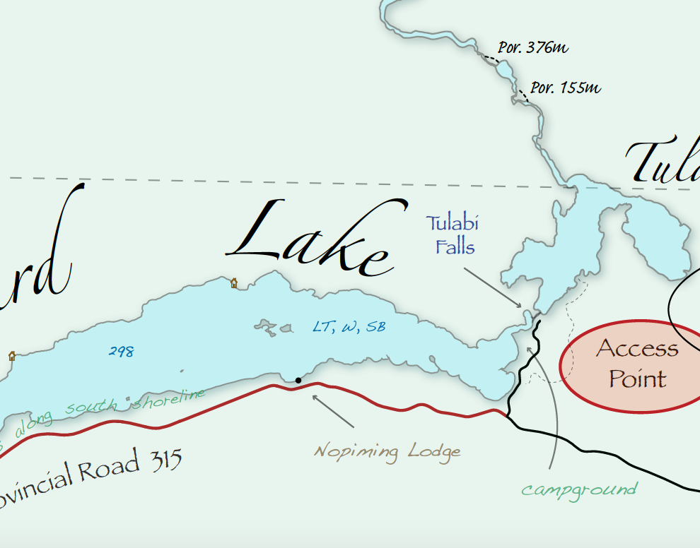
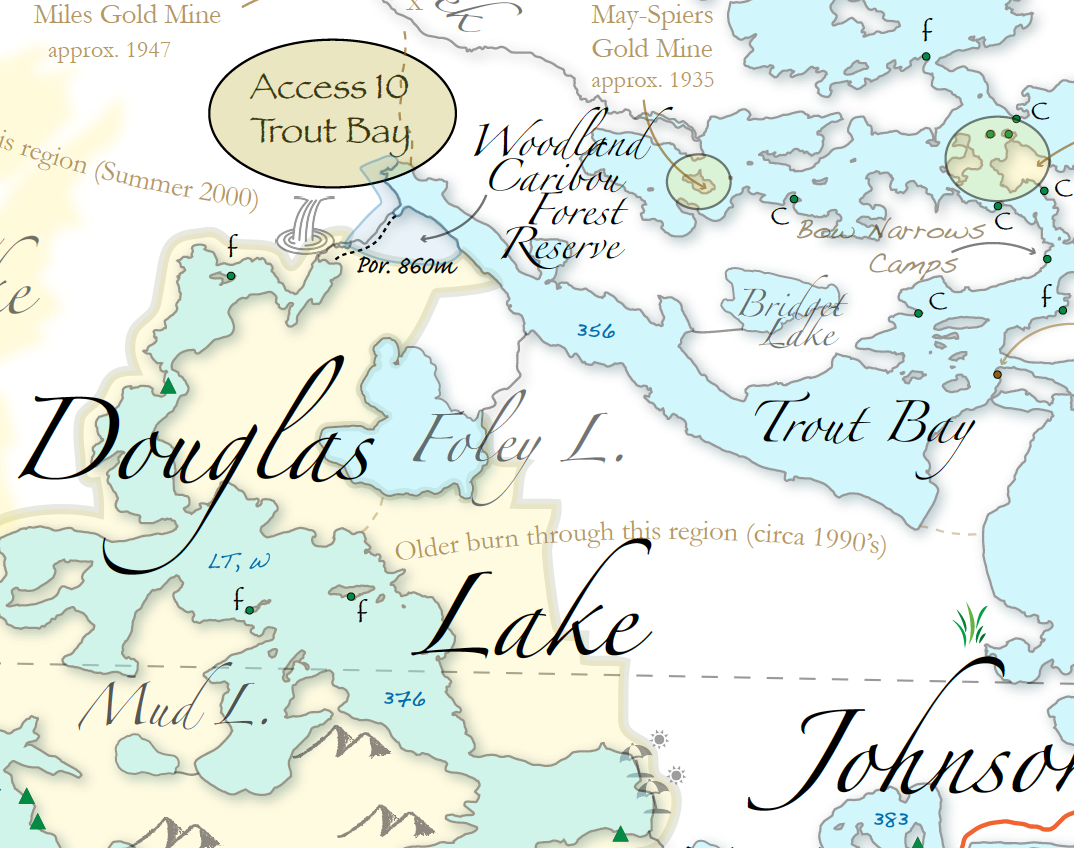
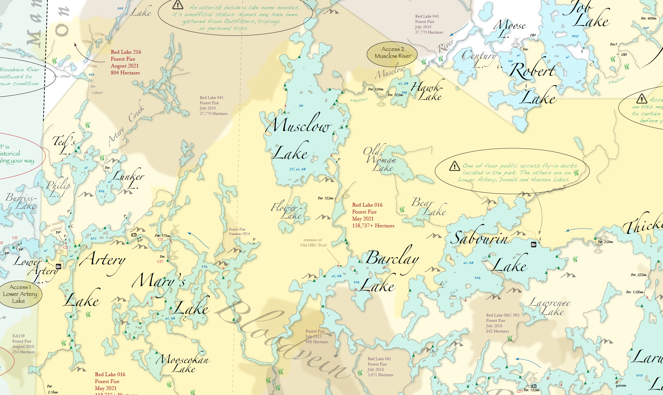
High Quality printed wall map (42″x32″) that covers the entire park. The map encompasses almost one million hectares of prairie boreal land in Northwestern Ontario. It includes many features unique to canoe route maps including forest fire history, mining history & suggested canoe routes. It includes all of the portages and campsites official to the MECP.


Woodland CaribouPP Canoe Route Planning Wall Map
$50.00
& Free Canadian Shipping42″ x 32″ ( 107cm x 81cm ) Large Canoe Routes Planning Wall Map of Woodland Caribou Provincial Park in Northwestern Ontario, Canada.
-This is an independent un-subsidized product
-Personally packaged and shipped by yours truly!
-High quality print on 24Ib. paper
-Very much a unique map with historical information, past forest fire regions, rapid classifications and suggested non-traditional canoe routes!
-Comes rolled in a tube for safe transport to you
-Makes a nice piece of ‘art’ for your winter gazing and dreaming!
It’s worth the drive to this quiet and beautiful region of the boreal forest!
Plan your trip here now with this valuable resource.
Contact me if you’re local (Kitchener-Waterloo, Ontario) – easier delivery and maybe a chat!
Free Shipping throughout Canada, flat fee of $12 for the United States!
Please allow 5-7 business days for delivery. 2-3 additional days for U.S. orders.
Out of stock
Reviews
There are no reviews yet.