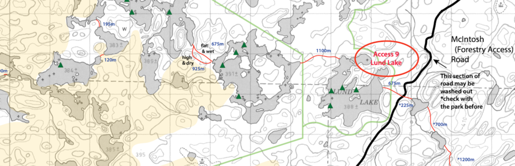
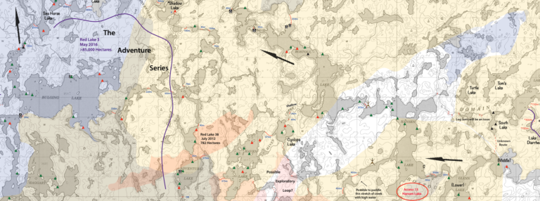
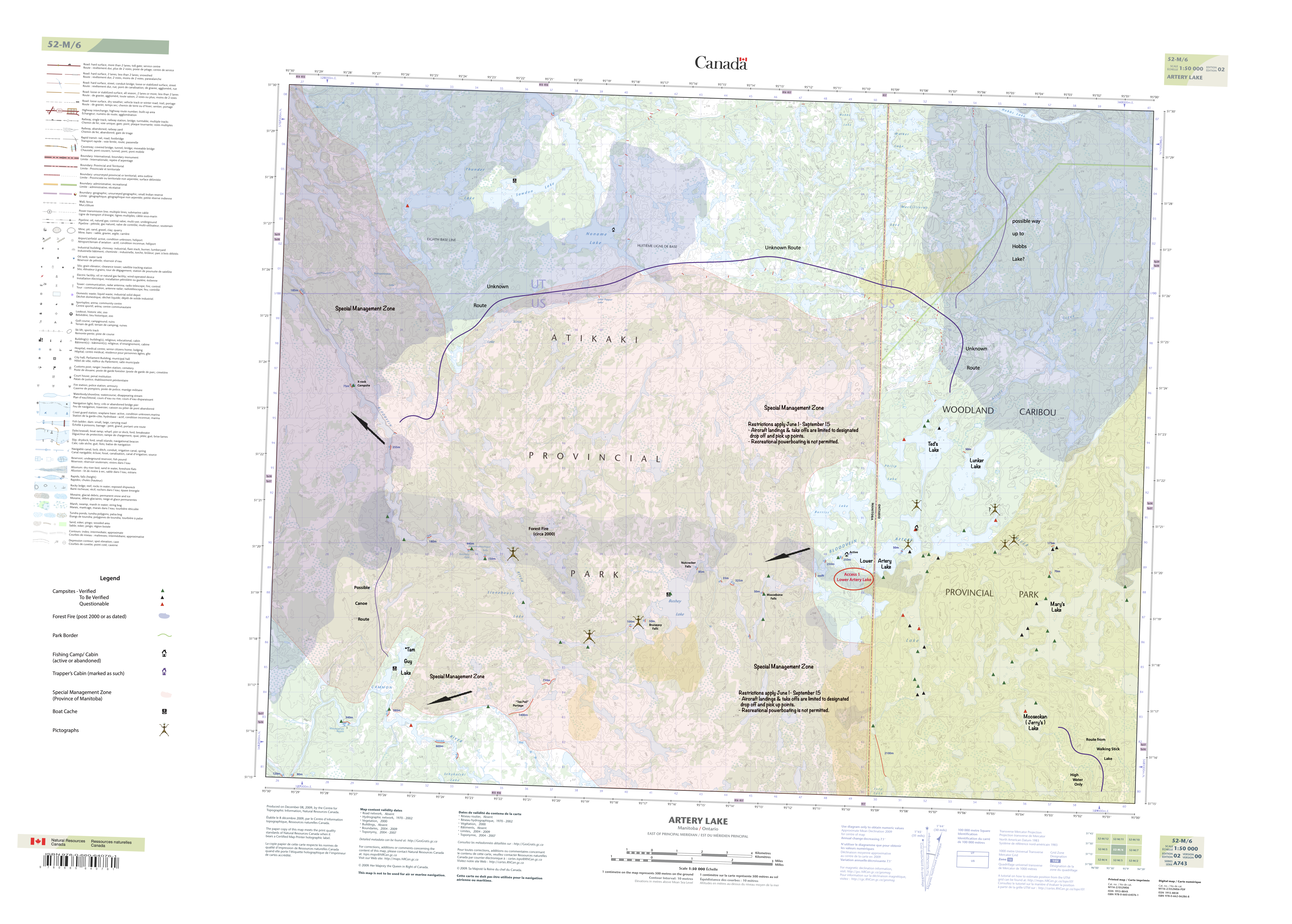
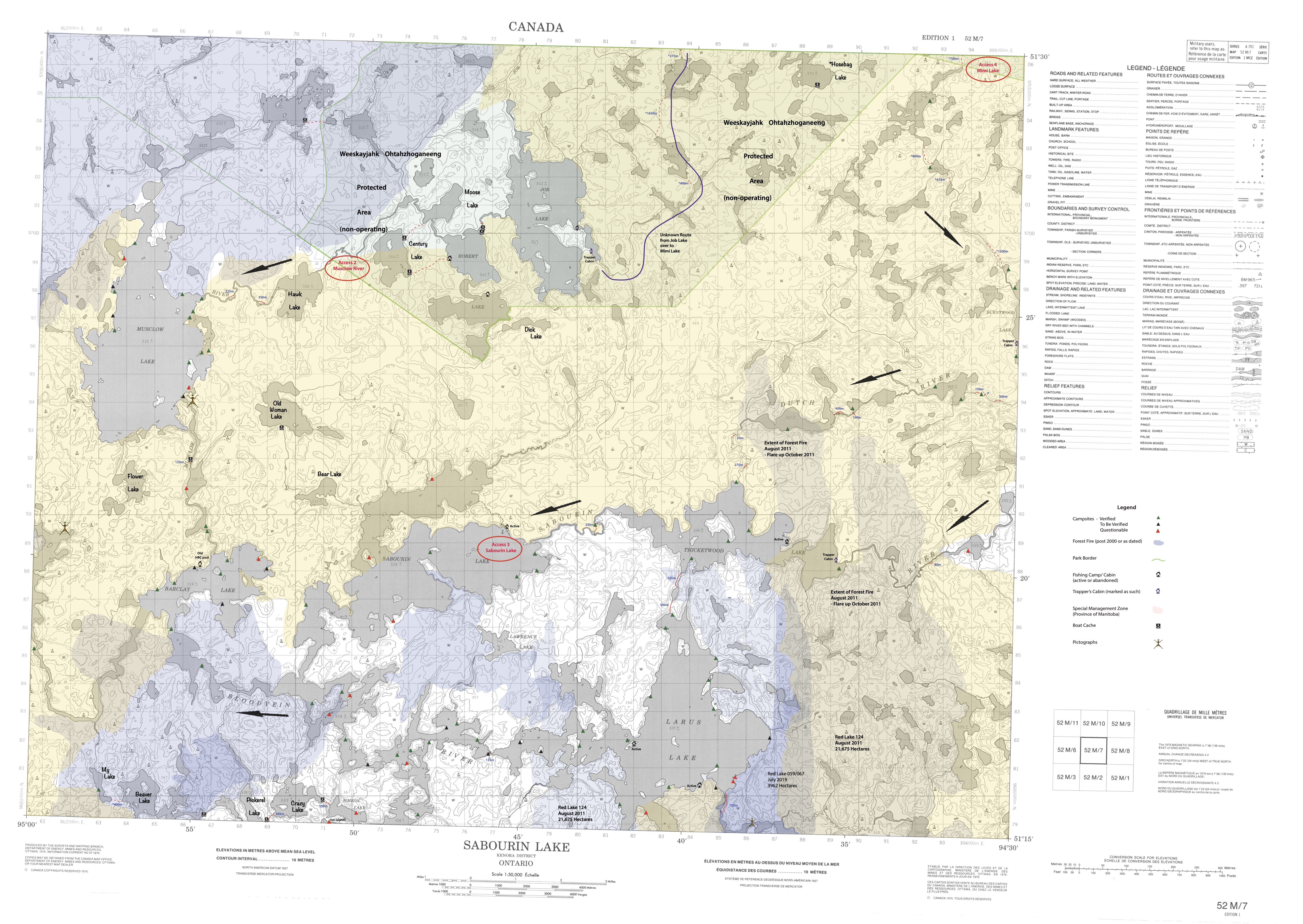
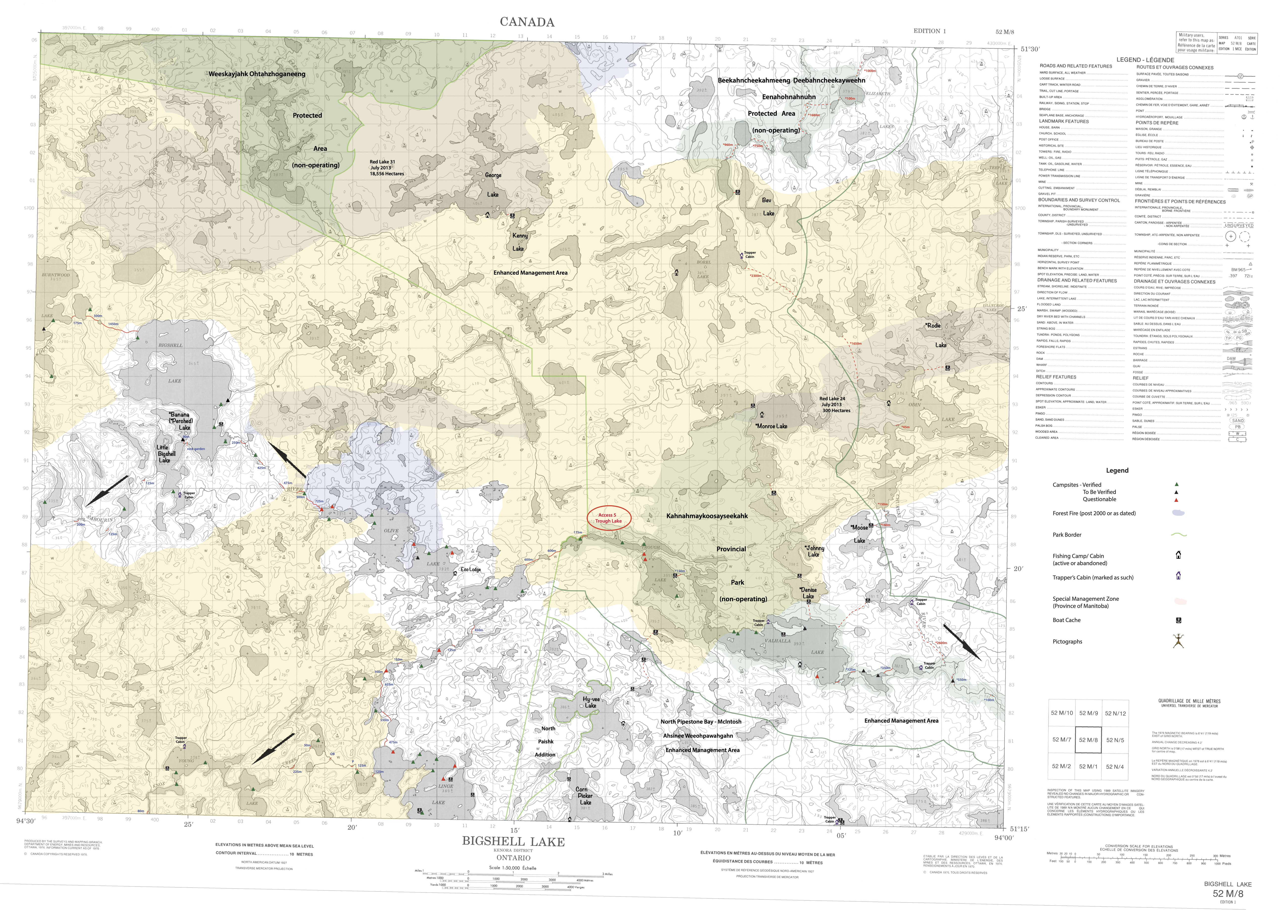
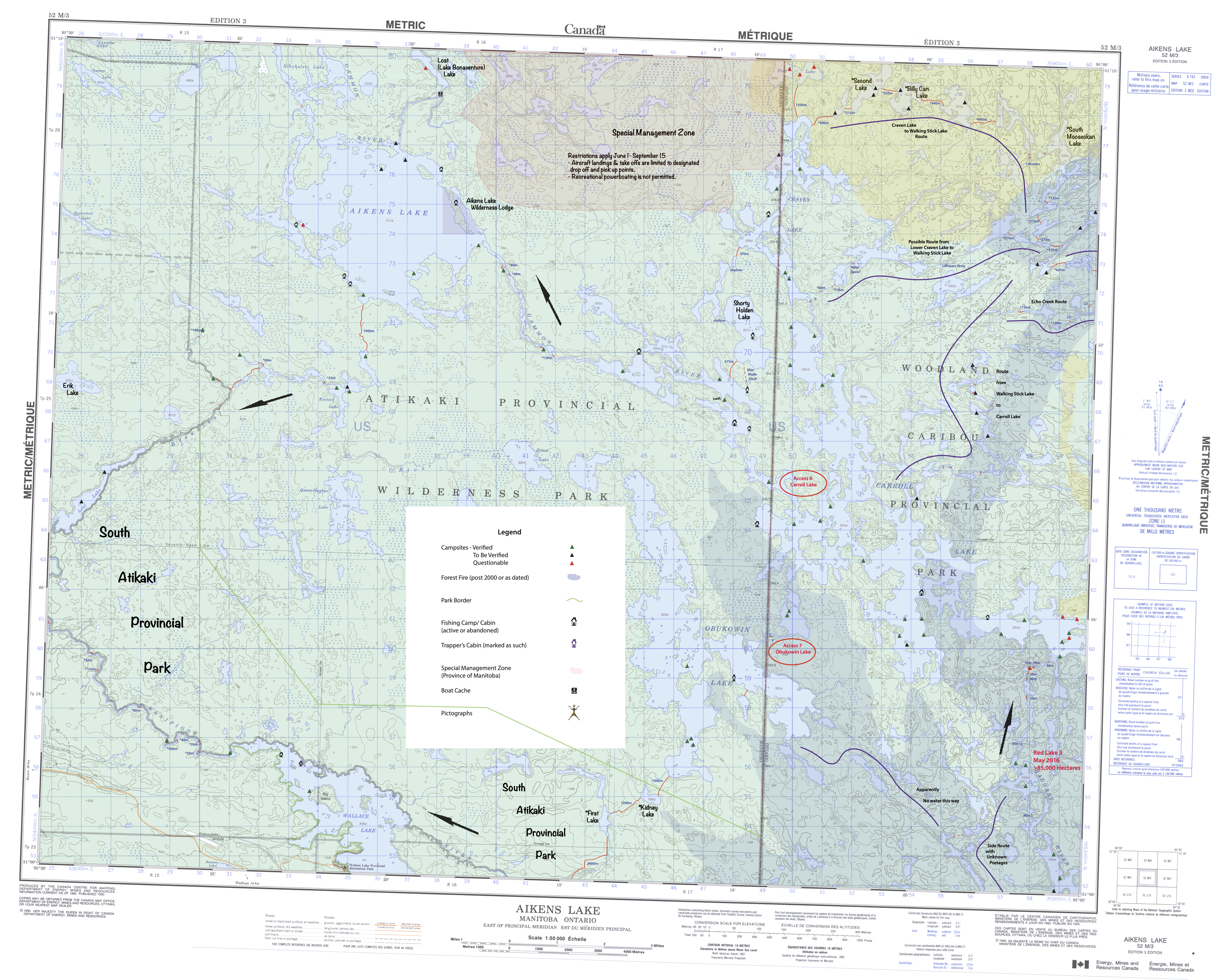
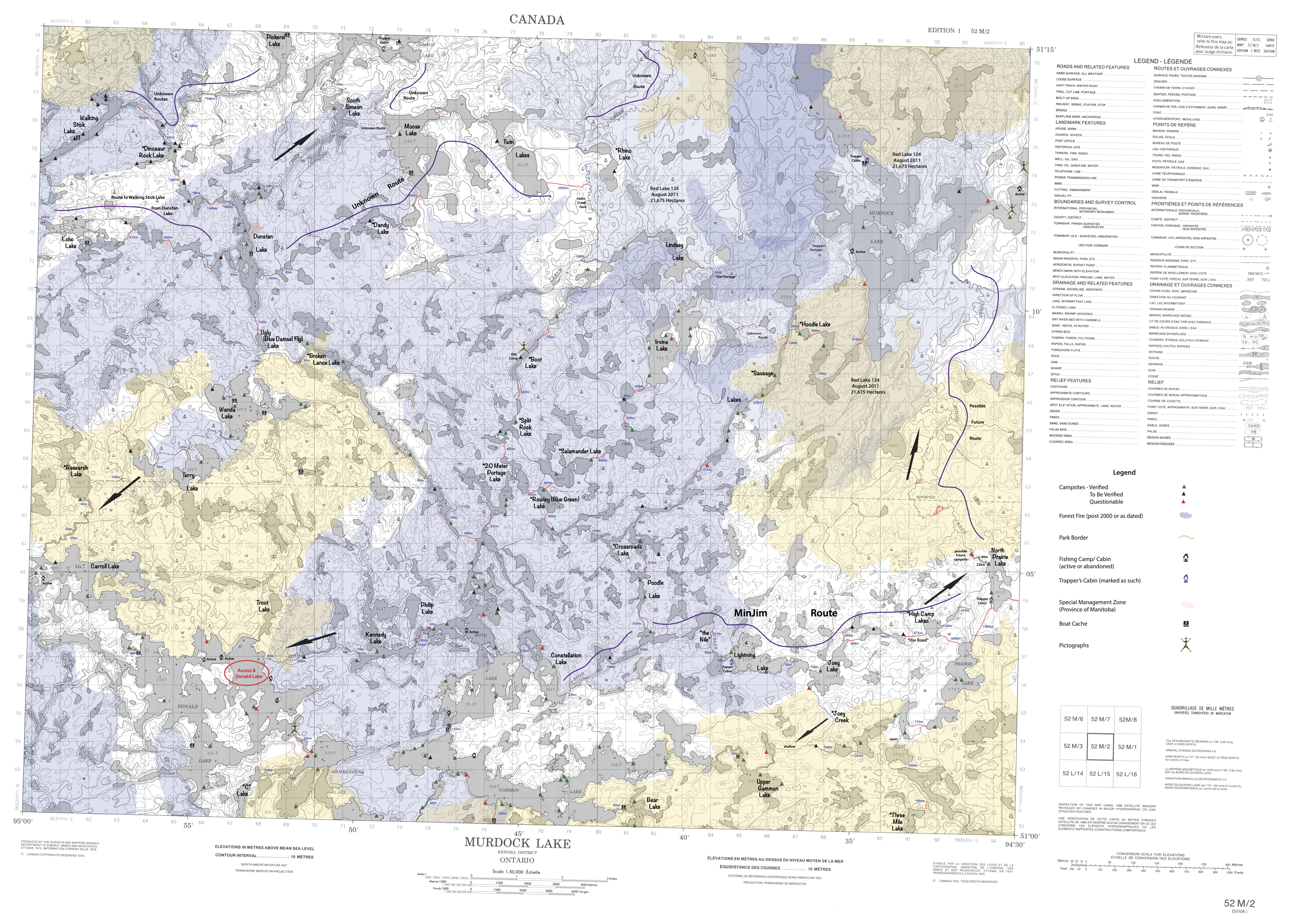
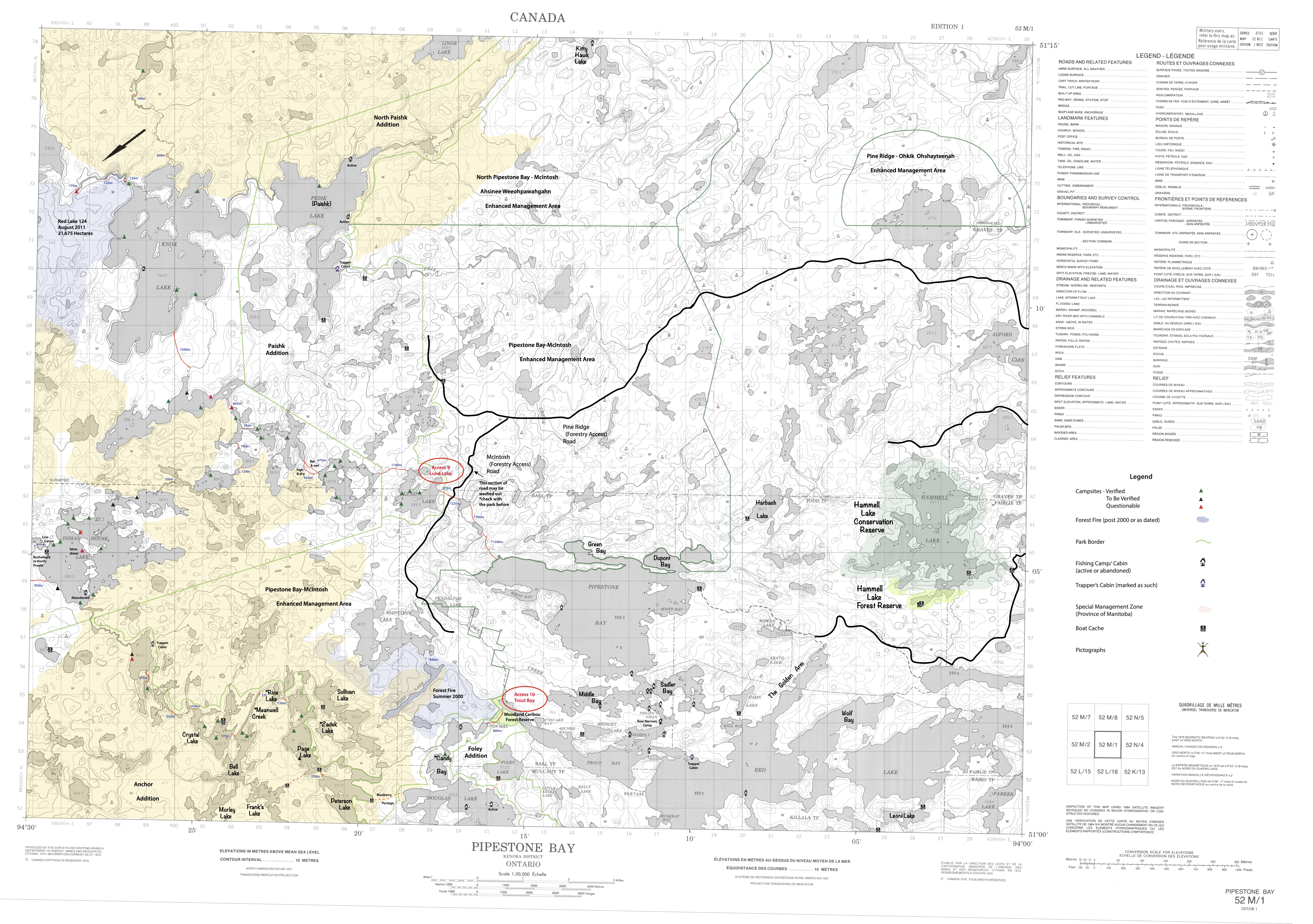
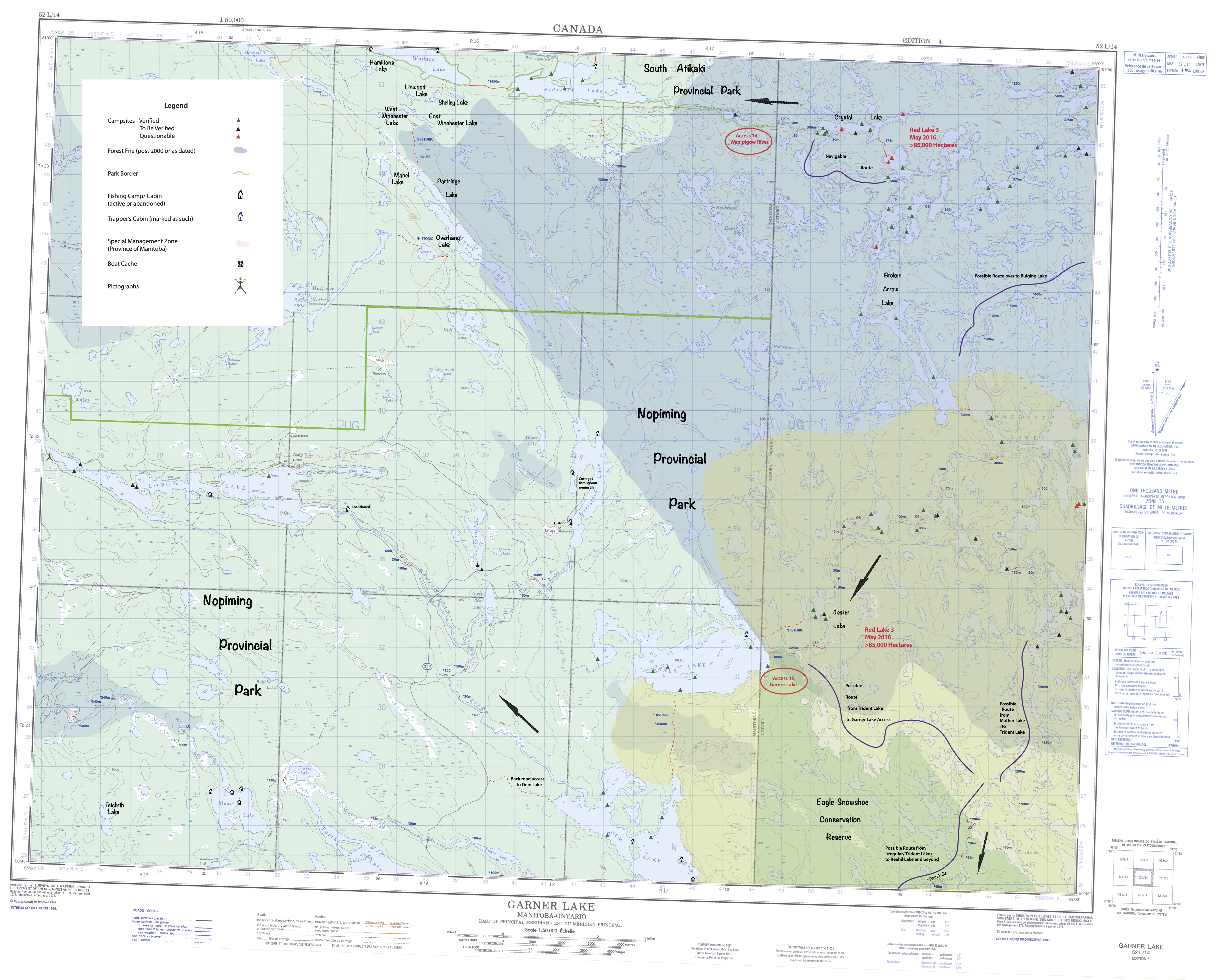
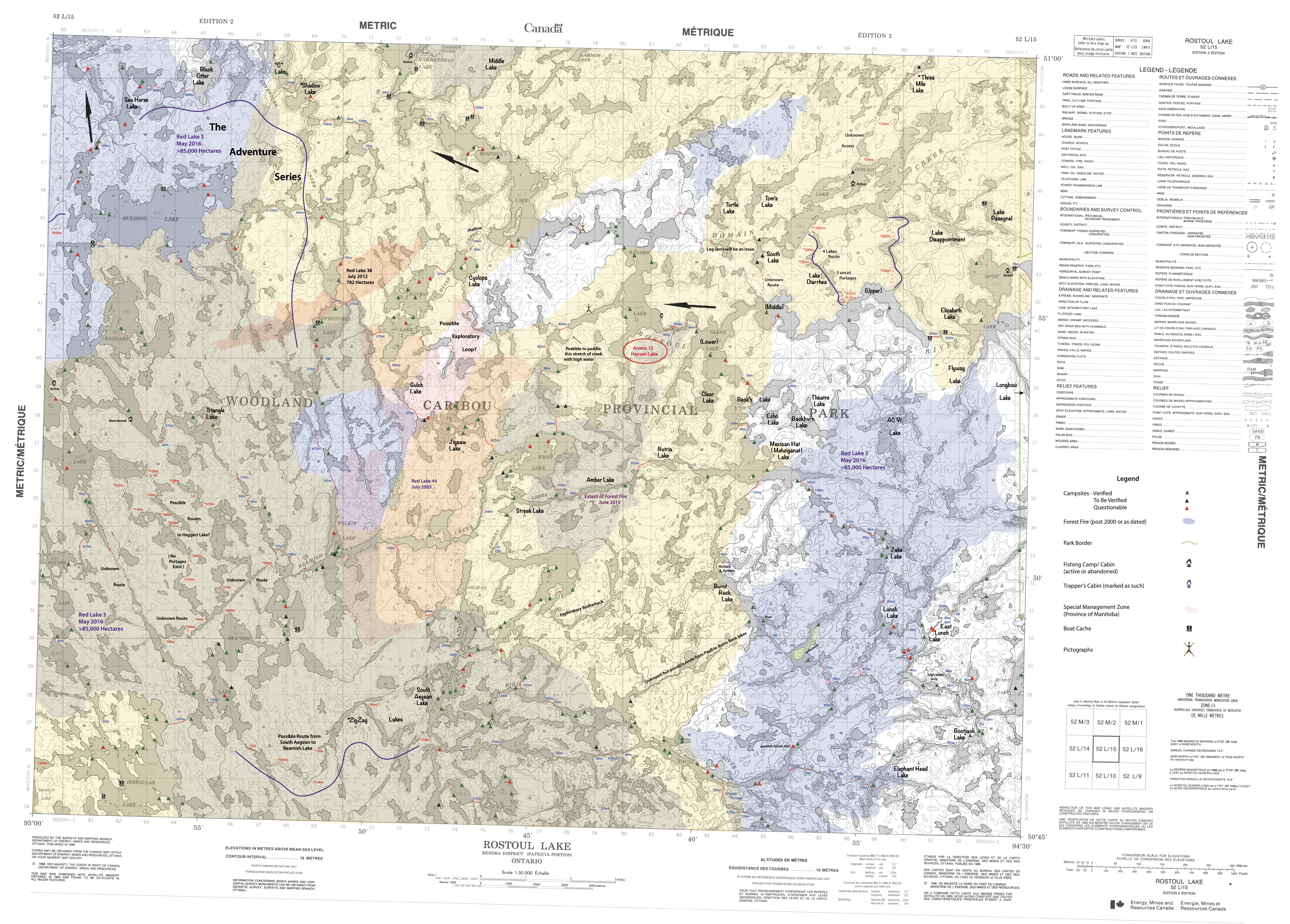
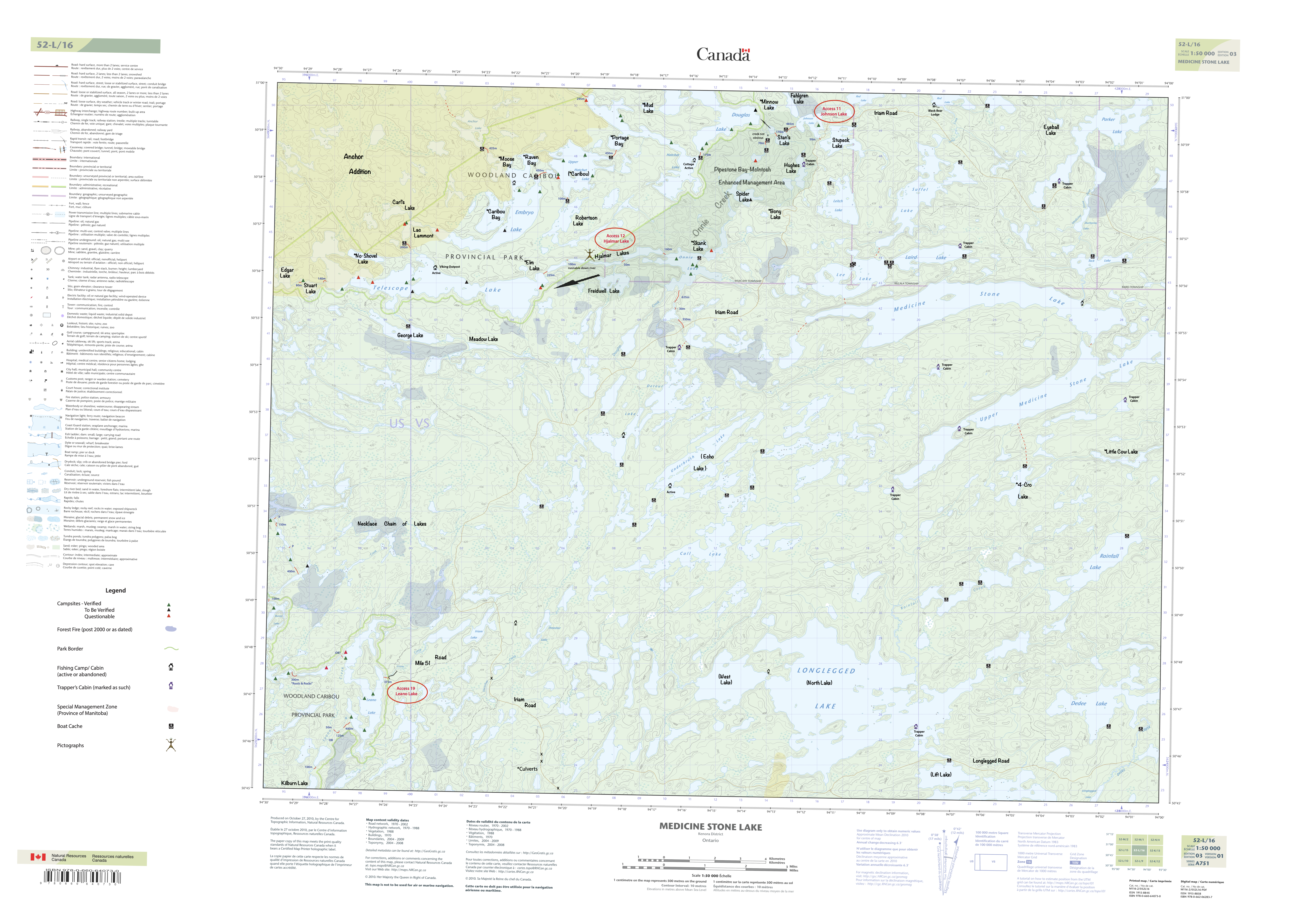
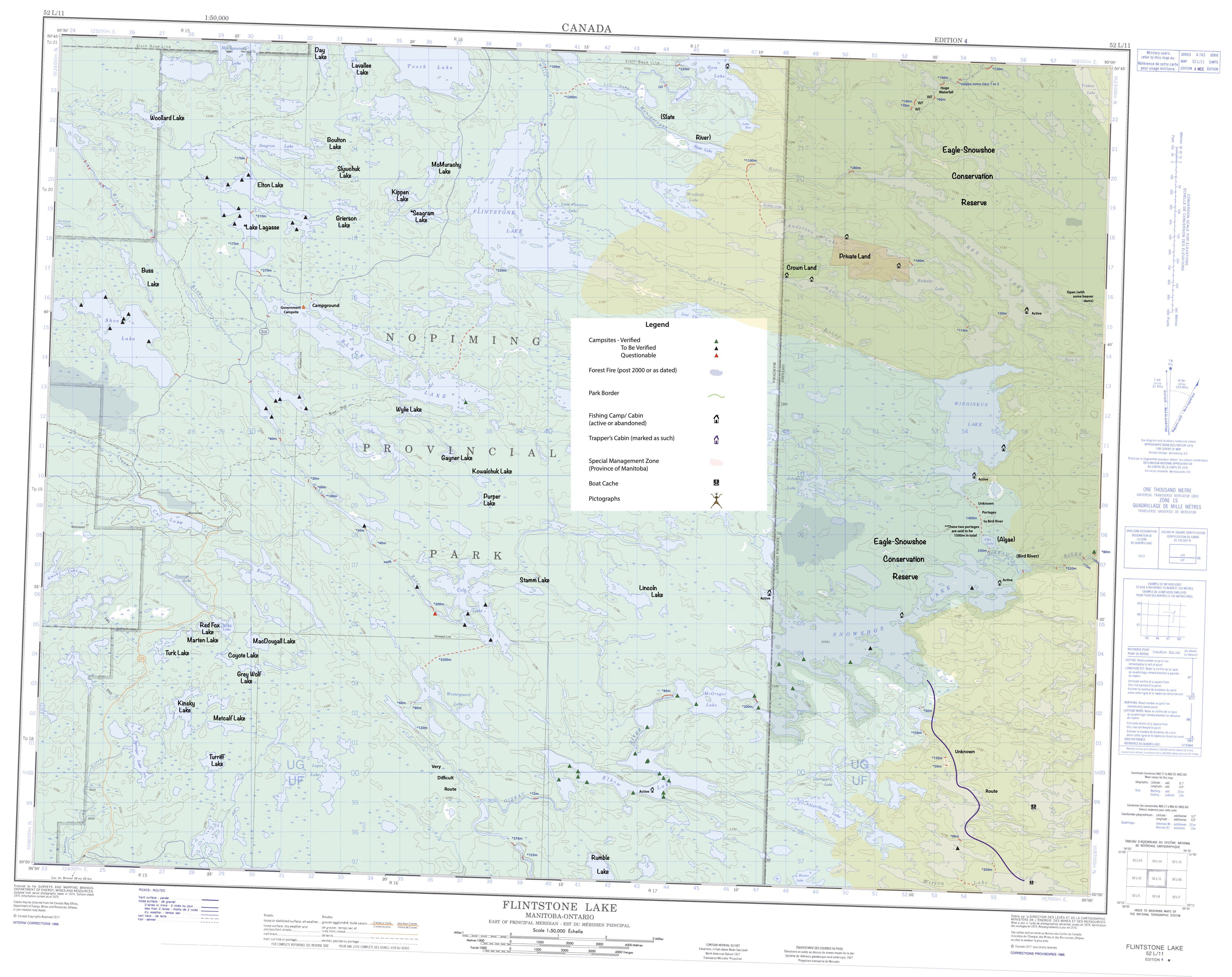
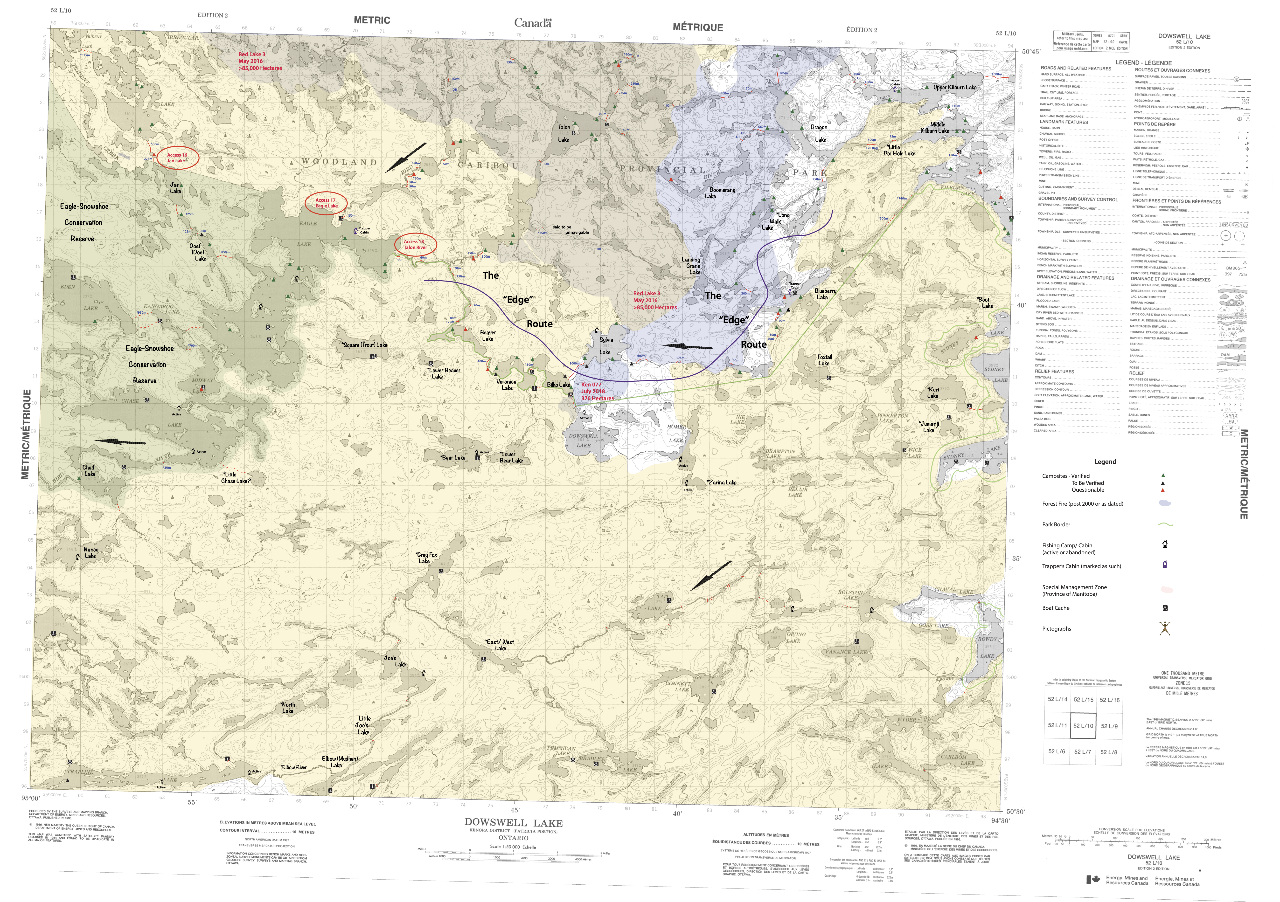
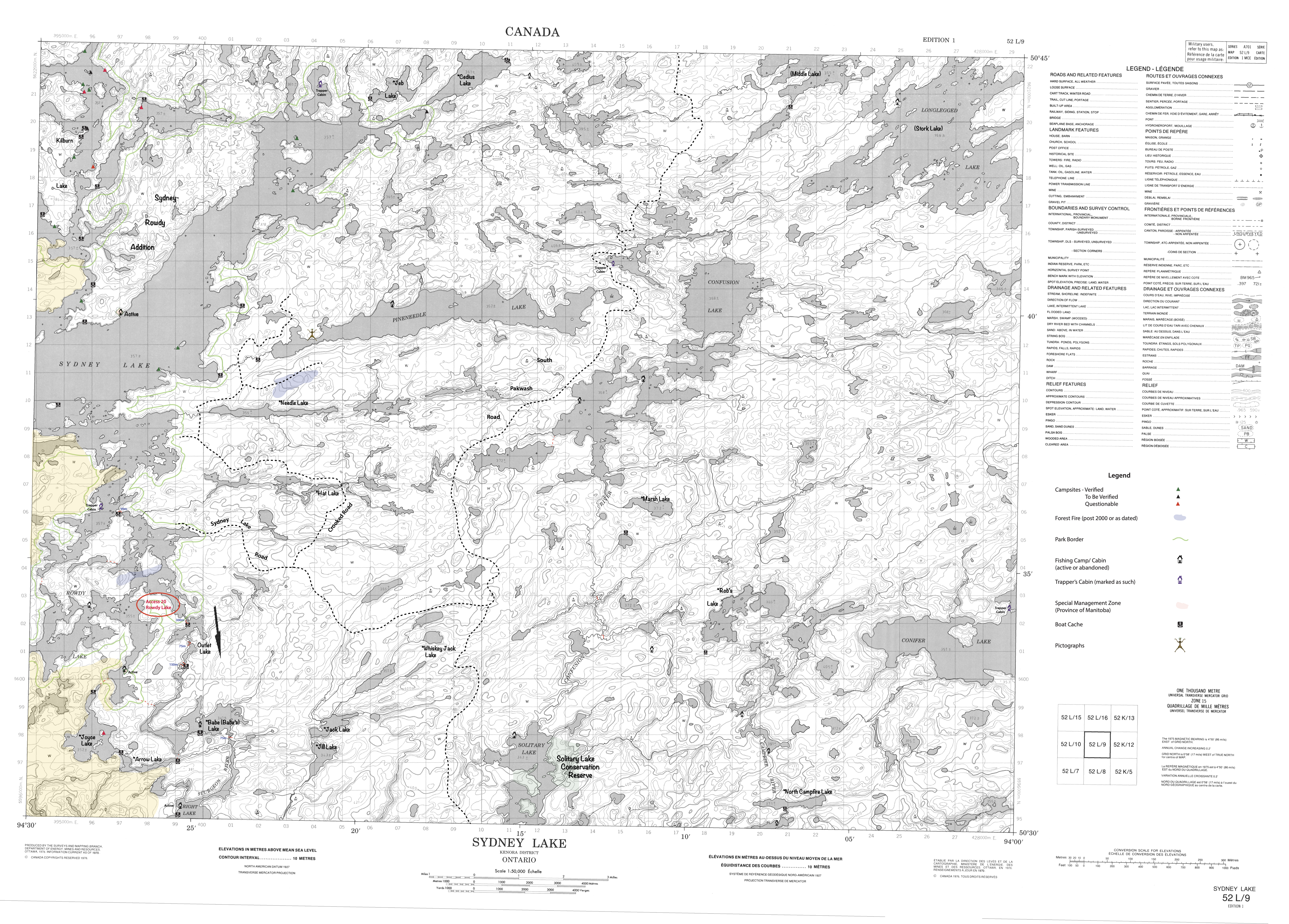
These downloadable topographic maps cover nearly the entirety of the MyWoodlandJourneys map and therefore all of Woodland Caribou Provincial Park. There are some minor inaccuracies among them as the information is slightly older. Forest fire coverage (including the entire 2021 season – shaded in a pale yellow) are all here though! Just as with the big map, USE THESE FOR PLANNING ONLY. Various information is included here in these maps that is not found on the big map and some information is only found on the big map. This is done on purpose and will unlikely change.
As with the big map, use at your own discretion! and please practice ‘leave no trace’ camping while out there!
Also with the big map, bring to my attention any discrepancies – please. And any contributions of GPX files, corrections etc. are very much appreciated! Feedback is always welcomed!