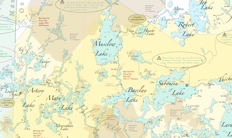
"This new map is just what the dreamers and adventurist in us needs. Knowing that the portage information's correct is so important in planning canoe routes to explore. So many times over twenty or thirty years the portages are moved because of fires or beaver activity. With this map spread out at home you will be able to plan out future routes with confidence that there are portages for the whole trip. Some of the routes are rarely used but if you are prepared to look for obscure signs of past usage, great adventures and solitude await. What a fantastic collection of tripping info on one page. I could not help but be reminded of Berard maps decades after he gathered the data. It really looks good and was so easy to pour over and check different sections."
Martin Kehoe
Canoeist/Explorer of over 30 years